
How do you explore for valuable mineral resources without drilling holes, disturbing wildlife, or altering the landscape?
That’s the core mission of our UNDERCOVER project: developing less invasive, more sustainable approaches to mineral exploration. In May and June 2025, our partners from the Czech Academy of Science (IG-CAS) and from the Geological Survey of Finland (GTK) conducted fieldwork in the Ruka region of northeast Finland, applying two passive advanced geophysical techniques: magnetotelluric (MT) measurements and passive seismic imaging.
These two geophysical methods are passive, meaning they do not involve introducing any artificial energy or signals into the ground. Instead, they rely on naturally occurring signals or fields already present in the environment, such as the Earth's magnetic field or natural seismic vibrations.
These methods allow us to “see” beneath the Earth’s surface - using only natural signals - to identify geological structures that may host mineral deposits.
Let’s deep dive into these two geophysical exploration methods.
What is Magnetotellurics (MT)?
Magnetotellurics (MT) is a passive geophysical method that measures natural variations in the Earth’s magnetic and electric fields. These variations - caused by solar activity and distant lightning storms - induce electric currents (called telluric currents) that flow through the subsurface.
By recording how these currents move through underground rocks, we can determine their electrical conductivity. Conductivity tells us a lot: for example, rocks that once carried mineral-rich fluids or contain metal ores (like copper, sulphides, or graphite) often conduct electricity better than surrounding material.
MT method helps scientists understand the large-scale tectonic history of the Earth's crust in a given area. It can create 3D maps showing where fluids - rich in minerals - may have moved upward from the mantle. By revealing these deep Earth processes, MT provides valuable insights into the larger picture of how mineral systems develop.
How are the MT Measurements carried out?
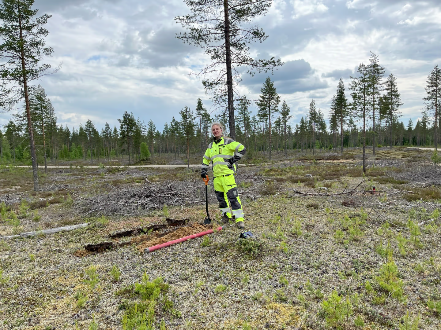
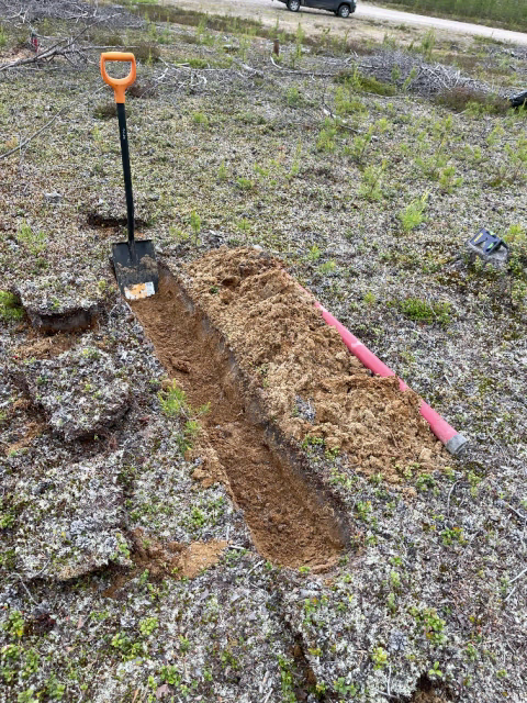
At each MT measurement point, we:
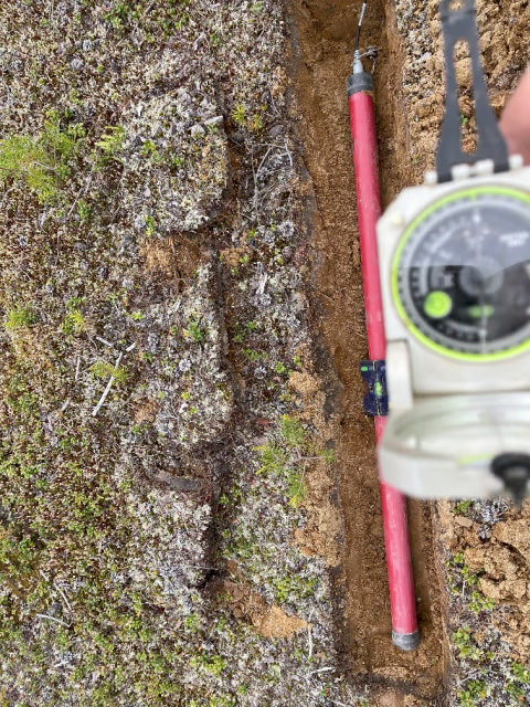
- Bury four electrodes in the ground to record electric field changes (two along a north-south line and two along an east-west line).
- Install three magnetometers - two horizontal and one vertical - to measure magnetic field variations.
- Connect everything to a data logger with a GPS, which records the signals for 48 hours.
These instruments capture a wide range of electromagnetic signals - from those that sense features close to the surface, to others that can reveal structures buried tens of kilometres deep. The result: a 3D image of the subsurface that helps us understand how mineral systems may have formed.
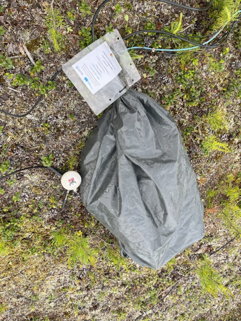
The process of MT measurement
On the left and middle, picture is a magnetometer about to be buried underground, on the right picture is the data logger, stored in a plastic bag for rain protection, with the GPS antenna outside
What is Passive Seismic Imaging?
While MT "listens" to electromagnetic fields, passive *seismic *imaging listens to natural vibrations of the Earth – a so-called seismic noise.
It is comprised of naturally occurring vibrations caused by atmospheric and anthropogenic disturbances, mostly by waves pounding against the shore. These can be detected even in areas far from the sea. Its omnipresence makes* seismic noise* an extremely convenient source of information.
Instead of generating vibrations (often by explosions, as in traditional "active" seismic surveys), we simply place sensitive sensors called seismometers in the ground and let them record this natural seismic background noise over months.
By analysing how seismic waves travel through the ground - especially their speed and direction - we can infer the density and type of rocks below. This helps us identify geological boundaries, faults, and buried rock units, all of which are important clues for mineral exploration.
How are the is the Passive Seismic Imaging carried out under UNDERCOVER?
In May, two of our UNDERCOVER project partners - IG-CAS and GTK - deployed 35 broadband stations across a large area (about 150 × 180 km). These stations can detect natural signals across a wide range of frequencies, allowing us to "see" deep into the Earth's crust. However, because the stations are spaced around 30 km apart, the spatial resolution isn’t very detailed.
To get a closer look at shallower structures, they also installed a second, denser network in June, composed of 500 low-cost geophone sensors placed about 1 km apart over a much smaller area. While these sensors can only detect signals from the top 1–2 kilometers of the crust, their dense spacing allows us to create much more detailed images of that shallow zone.
Our teams have already removed the geophone network in early August, after replacing batteries and checking equipment in July. The broadband stations will remain in place until late October or early November.
As a result of these signals extraction, our team will be ultimately able to create a 3D model of wave propagation speeds at different depths, reflecting the rock density and thus providing information about the distribution and different rock types underground.
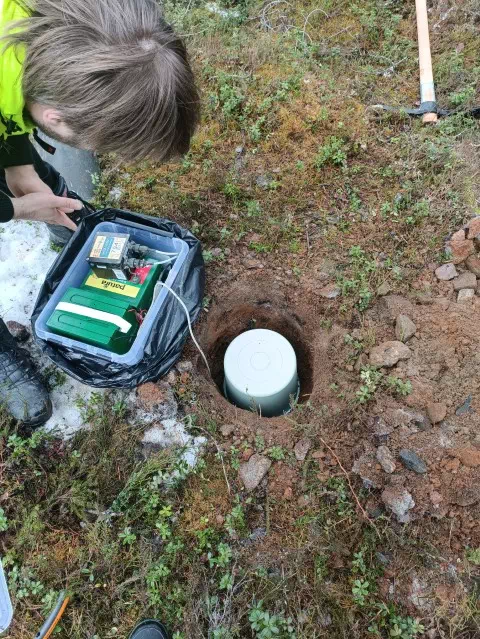
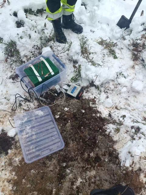
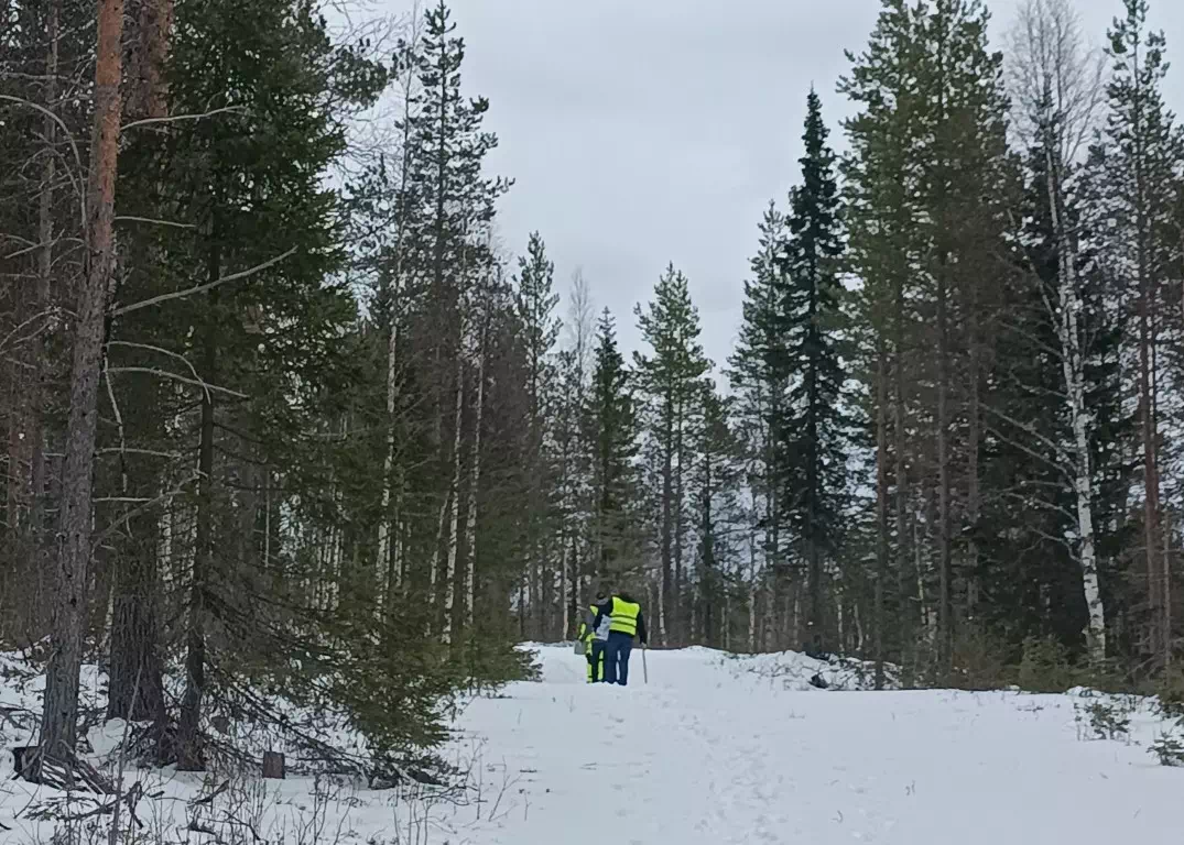
Broadband Seismometer Stations
On the left, you can see batteries and datalogger in a box, connected to the seismometer that is in the ground and below a bucket. On the right, the seismometer is already buried, and only batteries and datalogger are visible. A surprise late snowfall in May deposited around 30 cm of fresh snow just two days before we began our deployment, making access to some areas particularly difficult. On more recent trips, however, it's not snow but mosquitoes that challenged us!
What are we looking for in Ruka & What comes next?
The Kuusamo Belt is known as being a geologically complex region of Finland with known mineral potential. The goal within UNDERCOVER is to better understand the geological evolution of the region, which in turn (and in combination with other geophysical results) can lead to better-informed guesses on where potential exploration targets could be located - without having to drill first.
Once the equipment is collected and the data retrieved, we’ll begin the complex process of data analysis and 3D modelling. By combining MT data (which reveals electrical conductivity) with seismic imaging (which reveals rock density and layering), our partners will be able to better characterize its subsurface. The insights we gain will help unravel the tectonic and mineralisation history of the Kuusamo Belt. These data could guide eventual mining in a smarter way helping to pinpoint the most promising areas before any drilling takes place.
Kuusamo Belt is one of our three case studies. The other two are Iberian Pyrite Belt in Portugal and Kalahari Copper Belt in Namibia. Stay tuned to see how we discover the Earth’s hidden potential while minimising the harm to our planet.