
Mapping what lies beneath the Earth’s surface is a complex challenge, and doing it efficiently over large areas is even more so.
The UNDERCOVER project is testing innovative airborne geophysical technologies that can collect high-resolution subsurface data much faster than traditional ground-based methods, showcasing efficient geophysical investigation across Finland’s varied terrain, including our case study area, Kuusamo.
This approach boosts investigation efficiency and offers a more environmentally friendly alternative by minimizing ground disturbance and lowering the carbon footprint.
Why Airborne Technologies? Faster Data Collection at high resolution
Compared to ground-based methods, airborne geophysical techniques bring several benefits. First, they allow much faster mapping, covering larger areas in a shorter time. Second, they make it possible to acquire data in inaccessible areas or rough terrain, such as Finland’s lakes and swamps.
“The speed at which we can collect high-quality data with a large depth of investigation is a real game changer,” explains Anneke Thiede, geophysicist at the University of Münster. “As a comparison, during our last field work in Kuusamo, six semi-airborne electromagnetic flights covered around 40 km² at 250-meter line spacing in just six mornings, which (at this resolution) would have taken weeks using traditional ground-based methods!”
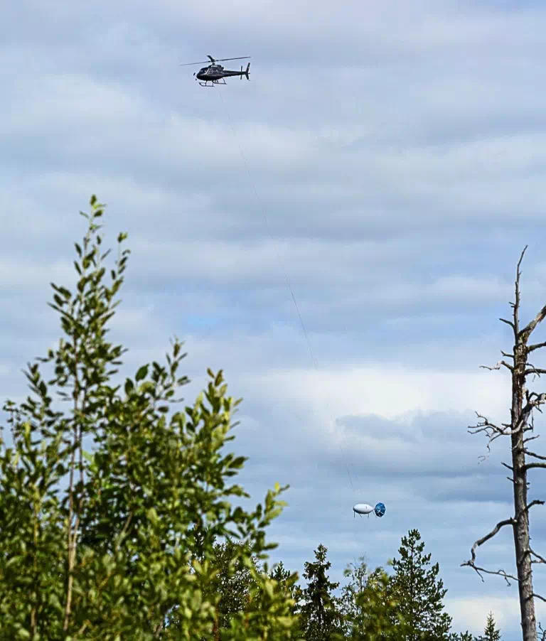
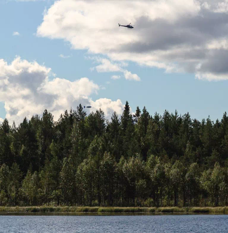
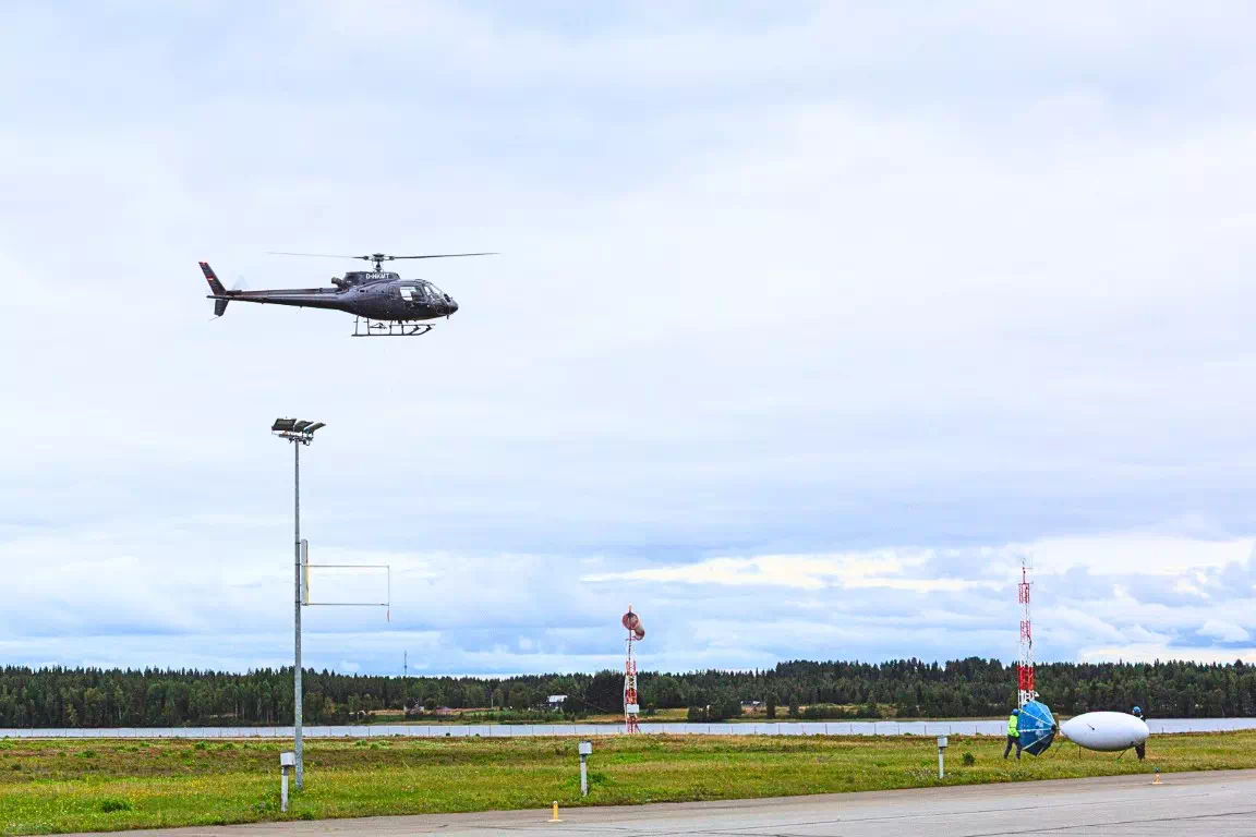
Here, “semi-airborne” refers to a hybrid approach: the transmitter that generates electrical currents is placed on the ground, while the receiver system is flown beneath a helicopter.
How is this airborne method actually working? Two complementary measurements.
In August, the team carried out a total of 12 measurement flights, two per day, one in the morning and one in the afternoon. Two complementary geophysical methods were tested, both probing the electrical conductivity of the Earth’s subsurface.
At the heart of both measurements lies the QAMT system, developed by the Leibniz-IPHT and Supracon AG. It consists of a platform weighing over 300 kilograms, carried beneath a helicopter on a 60-meter tow rope and flown about 60 meters above the ground. While in flight, it records the magnetic field using SQUID sensors (short for Superconducting Quantum Interference Device), which are among the most sensitive detectors available for measuring magnetic fields. (More the QAMT System and the SQUID sensors here.) Magnetic fields are recorded in three directions (X, Y, and Z), allowing scientists to build detailed 3D pictures of how different underground structures conduct electric currents.
Two different types of measurements were carried out using this QAMT system:
- Semi-airborne electromagnetic (EM) method: Morning flights focused on the semi-airborne electromagnetic (EM) method. Here, the team used a powerful ground-based transmitter (running at 1000 volts and up to 10 amperes) that sent electrical currents into the ground through electric grounding fields placed 2–5 km apart. The airborne QAMT system then measured the magnetic footprint, seeing how these currents spread below the surface, down to about 1km. In total, six flights were carried out to investigate the Juomasuo deposit, covering an area of about 40 km².
- Audio-Frequency MAGnetics (AFMAG) method: Afternoon flights switched to a passive technique, making use of the natural electromagnetic signal caused by thunderstorms. This method, called AFMAG (short for Audio-Frequency MAGnetics), is a passive measurement technique similar to magnetotellurics (MT – see our previous article), working without the need for an artificial transmitter. To support the interpretation of the results, five MT stations were set up as reference points. Using this technique, the team surveyed an area of about 1,600 km² and looked as deep as 2 km underground.
What does UNDERCOVER bring to the Table? From Deeper Measurements to more comprehensive 3D Subsurface Models
While most airborne methods are limited to shallow depths of around 300 meters, the technologies tested within UNDERCOVER can probe between one and two kilometers, offering new opportunities for mineral exploration research.
A key added value of UNDERCOVER is also the simultaneous use of multiple complementary methods. Until now, semi-airborne EM and AFMAG methods were mostly applied separately, each providing insights at its own scale (see publications from the DESMEX project – about the use of semi-airborne EM with helicopters here, and about AFMAG data here).
The team is currently processing the data to calculate so-called “transfer functions”, which connect the signals recorded by the airborne platform with the recordings on the ground: Semi-airborne EM transfer functions refer to the injected current, while AFMAG transfer functions refer to the MT-stations. By linking airborne measurements to their corresponding ground-based signals, transfer functions allow the raw data to be converted into 3D-models, revealing variations in rock conductivity and the structure of the subsurface. The final step will be the integration of both airborne methods and ground-based methods to a single, multi-scale model.
A promising start!
So far, the airborne fieldwork carried under UNDERCOVER has been a success. Not only did the team manage to collect the data it needed, but collaboration among all partners also went seamlessly. Indeed, airborne surveys require careful coordination among multiple teams, in our case the helicopter crew, platform specialists from Supracon AG, and ground teams from GTK, Leibniz-IPHT, and the University of Münster. Despite this being the first time we carried out measurements with this team configuration, the process went off without a hitch.
“It was impressive to see how well the different teams worked together, from the helicopter pilot to the geophysicists,” says Anneke Thiede, geophysicist at the University of Münster. “Each flight was a small organisational challenge, but every morning everything clicked into place.”
Favorable weather also played a key role, especially given that for such low-altitude flights, poor conditions like fog could have posed delays in the workflow.
This initial airborne fieldwork collection was promising, and exciting updates are on the way. Stay tuned and sign up to our newsletter here not to miss the next insights and results from UNDERCOVER!